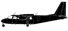
ASN Wikibase Occurrence # 326261
| Date: | Tuesday 8 August 1989 |
| Time: | 10:35 |
| Type: |  Britten-Norman BN-2A-26 Islander |
| Owner/operator: | Aspiring Air |
| Registration: | ZK-EVK |
| MSN: | 583 |
| Year of manufacture: | 1977 |
| Total airframe hrs: | 8350 hours |
| Engine model: | Lycoming O-540-E4C5 |
| Fatalities: | Fatalities: 10 / Occupants: 10 |
| Aircraft damage: | Destroyed, written off |
| Category: | Accident |
| Location: | Upper Dart Valley -
 New Zealand New Zealand
|
| Phase: | En route |
| Nature: | Passenger - Non-Scheduled/charter/Air Taxi |
| Departure airport: | Wanaka Airport (WKA/NZWF) |
| Milford Sound Airport (MFN/NZMF) | |
| Investigating agency: | TAIC |
| Confidence Rating: |
Islander ZK-EVK departed from Wanaka on a VFR scenic flight to Milford Sound but failed to arrive. Wreckage from the aircraft was subsequently located on steep snow covered mountainous terrain at elevations up to 5400 feet. Following initial impact, major portions of the aircraft, including the fuselage, had fallen over precipitous bluffs.
PROBABLE CAUSE: "The lack of direct evidence to account, operationally or structurally, for the manner in which the aircraft struck the mountain slope, the remoteness of the site which provided no witness observation to describe the aircrafts flight path prior to the event and the absence of any survivor, combined to preclude a determination of the accidents probable cause."
Accident investigation:
 |
|
Sources:
Aircraft Accident Report No. 89-066 Britten-Norman BN2A Islander ZK-EVK, collided with terrain, Upper Dart Valley, 8 August 1989
Location
Revision history:
| Date/time | Contributor | Updates |
|---|
The Aviation Safety Network is an exclusive service provided by:


 ©2024 Flight Safety Foundation