ASN Wikibase Occurrence # 323979
| Date: | Thursday 14 May 1998 |
| Time: | 15:25 |
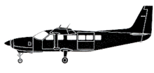
| Type: |  Cessna 208 Caravan I |
| Owner/operator: | Baker Aviation |
| Registration: | N192AV |
| MSN: | 20800215 |
| Year of manufacture: | 1992 |
| Total airframe hrs: | 5574 hours |
| Engine model: | Pratt & Whitney Canada PT6A-114 |
| Fatalities: | Fatalities: 0 / Occupants: 10 |
| Aircraft damage: | Substantial, repaired |
| Category: | Accident |
| Location: | 9 km NE of Nome Airport, AK (OME) -
 United States of America United States of America
|
| Phase: | Approach |
| Nature: | Passenger - Scheduled |
| Departure airport: | Kotzebue Airport, AK (OTZ/PAOT) |
| Nome Airport, AK (OME/PAOM) | |
| Investigating agency: | NTSB |
| Confidence Rating: |
Flight 435 departed Kotzebue (OTZ) at 14:02. After departure, the pilot indicated an obscured ceiling began to lower in an area about 70 miles (112 km) south of Kotzebue. He said the airplane was in cruise flight at 4,500 feet mean sea level while en route to Nome (OME). As the flight progressed southbound, the ceilings continued to lower, and the pilot said he descended to 2,500 feet. About 12 miles 919 km) north of Nome, the pilot indicated he descended to 1,500 feet, and the visibility was between 3 to 4 miles. At 15:15, about 6 miles 910 km) north of Nome, the pilot contacted the Nome Automated Flight Service Station (AFSS), and obtained an airport advisory. The Nome flight service station specialist reported the Nome airport advisory as: "...wind, 080 degrees, at 20 knots, favoring runway 09, altimeter 29.63; Nome weather, IFR, visibility 1 mile in light snow and mist, ceiling 1,000 feet broken, 1,500 feet overcast." The pilot descended to 1000 feet. When the visibility decreased to 1 mile, he decided to begin a right turn back to an area of better visibility. During the turn, the pilot said he entered white-out conditions. He leveled the wings of the airplane, and applied engine power to begin a climb. The airplane then collided with the snow covered terrain of Newton Peak, about 850 feet msl.
PROBABLE CAUSE: "The pilot's continued VFR flight into instrument meteorological conditions. Factors in the accident were low ceilings, whiteout conditions, and snow covered terrain. "
Accident investigation:
 |
|
Sources:
NTSB
Location
Revision history:
| Date/time | Contributor | Updates |
|---|
The Aviation Safety Network is an exclusive service provided by:


 ©2024 Flight Safety Foundation