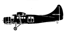
ASN Wikibase Occurrence # 322560
| Date: | Friday 27 August 2004 |
| Time: | 16:00 |
| Type: |  de Havilland Canada DHC-3 Otter |
| Owner/operator: | Mavrik Aire |
| Registration: | N197TT |
| MSN: | 197 |
| Year of manufacture: | 1956 |
| Engine model: | Pratt & Whitney R-1340 |
| Fatalities: | Fatalities: 1 / Occupants: 3 |
| Aircraft damage: | Destroyed, written off |
| Category: | Accident |
| Location: | 56 km W of McGrath, AK -
 United States of America United States of America
|
| Phase: | En route |
| Nature: | Executive |
| Departure airport: | McGrath Airport, AK (MCG/PAMC) |
| Unalakleet Airport, AK (UNK/PAUN) | |
| Investigating agency: | NTSB |
| Confidence Rating: |
DHC-3 N197TT was one of two aircraft that departed McGrath for Unalakleet and Kotzebue to transport hunting camp supplies. Instrument meteorological conditions consisting of mist, fog, and smoke, prevailed in the area of the accident. Because of this, the Otter flew about 500 to 1,000 feet above the ground. Suddenly a mountain ridge appeared in front of the airplane. The pilot banked the airplane to the left, and added engine power. A few seconds later the airplane touched trees and descended into the ground, coming to rest upright. The survivors spent two nights at the wreckage under heavy forest fire smoke and severe weather before they were spotted by rescue crews.
PROBABLE CAUSE: "The pilot's inadequate in-flight planning/decision making, his continued VFR flight into instrument meteorological conditions, and his failure to maintain obstacle clearance. Factors contributing to the accident were low ceilings due to smoke, rain, and mist."
Accident investigation:
 |
|
Sources:
Anchorage Daily News
FAA
NTSB
Location
Revision history:
| Date/time | Contributor | Updates |
|---|
The Aviation Safety Network is an exclusive service provided by:


 ©2024 Flight Safety Foundation