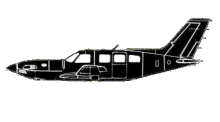
ASN Wikibase Occurrence # 183316
This information is added by users of ASN. Neither ASN nor the Flight Safety Foundation are responsible for the completeness or correctness of this information.
If you feel this information is incomplete or incorrect, you can submit corrected information.
| Date: | Tuesday 23 September 2003 |
| Time: | 12:55 |
| Type: |  Piper PA-46-350P Malibu Mirage JetPROP DLX |
| Owner/operator: | Private |
| Registration: | N146PM |
| MSN: | 4622160/108 |
| Fatalities: | Fatalities: 0 / Occupants: 1 |
| Aircraft damage: | Substantial |
| Category: | Accident |
| Location: | North Las Vegas, NV -
 United States of America United States of America
|
| Phase: | Unknown |
| Nature: | Private |
| Departure airport: | N. Las Vegas, NV (VGT) |
| Salt Lake City, UT (SLC) | |
| Investigating agency: | NTSB |
| Confidence Rating: |
Piper PA-28R-200 Cherokee Arrow N8604N was landing on runway 12R and Piper PA-46-310P Malibu JetPROP DLX N146PM, (conv. #108) had started the takeoff roll on runway 7 when they collided at the intersection of the two runways. The Piper Arrow was cleared to land on runway 12R, 54 seconds before the Piper Mirage was given a takeoff clearance on the intersecting runway. During this time frame, the local controller and local assist controller were both viewing the D-Brite radar and looking out the tower cab's rear windows for a helicopter that had entered the class D airspace without authorization. With both controllers attention diverted to the helicopter, they failed to effectively monitor the runway operation and did not ensure proper separation was maintained between the two airplanes operating on the intersecting runways. Radar data indicated when the pilot of the Piper Arrow contacted the LC-1 controller and reported inbound for landing, the airplane was approximately 6 miles north-northeast of the airport and tracking a course of about 200 degrees. The airplane remained on that course, and the pilot was cleared to land when the airplane was approximately 2 1/4 miles north-northwest of the airport. About 20 seconds later the airplane began a left turn towards the airport. The airplane’s radar track indicated the pilot of the Piper Arrow flew a standard base leg to final approach, in accordance with the issued clearance. When the LC-1 controller cleared the pilot of the Piper Mirage for takeoff, the Piper Arrow was about 1 1/2 miles northeast of the airport on final to runway 12R with the data tag on the D-Brite radar showing a ground speed of 110 knots. Assuming that Piper Arrow’s ground speed remained 110 knots or less during the remainder of the approach, the airplane was about 1 minute away from touchdown. This meant that the pilot of the Piper Mirage had less than 1 minute to power up his aircraft, taxi on to runway 7, begin a departure roll, and travel about 725 feet in order to pass through the intersection of runway 12R before the Piper Arrow crossed the landing threshold for runway 12R. While this is not impossible, the minimal time available for Piper Mirage to depart before the Piper Arrow arrived warranted close monitoring by the controllers to ensure that separation was maintained at the intersection.
Probable Cause: the failure of the Federal Aviation Administration Air Traffic Control Tower local controller and local assist controller to effectively monitor the runway operation and ensure proper separation was maintained between aircraft on intersecting runways.
Sources:
NTSB: https://www.ntsb.gov/_layouts/ntsb.aviation/brief.aspx?ev_id=20030925X01600&key=1
Revision history:
| Date/time | Contributor | Updates |
|---|---|---|
| 09-Jan-2016 00:50 | JINX | Added |
| 25-Apr-2017 14:44 | TB | Updated [Date, Time, Aircraft type, Registration, Cn, Operator, Total fatalities, Total occupants, Location, Phase, Nature, Source, Damage, Narrative] |
| 08-Dec-2017 19:29 | ASN Update Bot | Updated [Time, Operator, Total fatalities, Total occupants, Nature, Departure airport, Destination airport, Source, Damage, Narrative] |
| 21-Dec-2020 07:27 | RobertMB | Updated [Aircraft type, Narrative] |
Corrections or additions? ... Edit this accident description
The Aviation Safety Network is an exclusive service provided by:


 ©2024 Flight Safety Foundation