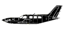
ASN Wikibase Occurrence # 87460
This information is added by users of ASN. Neither ASN nor the Flight Safety Foundation are responsible for the completeness or correctness of this information.
If you feel this information is incomplete or incorrect, you can submit corrected information.
| Date: | Sunday 9 January 2011 |
| Time: | 13:40 |
| Type: |  Piper PA-46-350P Malibu Mirage JetPROP DLX |
| Owner/operator: | Private |
| Registration: | N727MC |
| MSN: | 4636085/191 |
| Year of manufacture: | 1997 |
| Total airframe hrs: | 3734 hours |
| Engine model: | P&W Canada PT6A-35 |
| Fatalities: | Fatalities: 2 / Occupants: 2 |
| Aircraft damage: | Destroyed |
| Category: | Accident |
| Location: | Sangre de Christo Mountains, CO -
 United States of America United States of America
|
| Phase: | En route |
| Nature: | Private |
| Departure airport: | Phoenix, AZ (DVT) |
| Pueblo, CO (PUB) | |
| Investigating agency: | NTSB |
| Confidence Rating: |
While en route to the destination airport, the pilot was issued a clearance to descend. As the airplane descended to the assigned altitude, radar plots depicted the airplane entering a right turn, climbing rapidly, and then descending rapidly in a spiral-like pattern. The airplane wreckage was found the following day in mountainous terrain. Several tall trees surrounded the perimeter of the wreckage. Many of the trees showed scuff marks down the trunks consistent with the airplane impacting the terrain in a near-vertical descent. All airplane components were accounted for at the accident site. A postaccident examination of the airplane showed no preimpact failures of the airframe or the engine. A weather analysis revealed that the airplane was descending in the immediate vicinity of a stationary front. The weather conditions in the area were conducive to the production of moderate to severe turbulence, mountain wave activity with updraft/downdrafts in excess of 750 feet per minute, and moderate icing. The radar data confirmed that the airplane began its rapid descent shortly after entering cumuliform clouds. The radar information along with the wreckage at the accident site was consistent with the pilot losing control while trying to maneuver the airplane in an area of turbulent weather.
Probable Cause: The pilot's loss of control following an encounter with moderate to severe weather.
Accident investigation:
 |
|
Sources:
NTSB
Location
Revision history:
| Date/time | Contributor | Updates |
|---|---|---|
| 10-Jan-2011 02:50 | gerard57 | Added |
| 10-Jan-2011 04:58 | gerard57 | Updated [Departure airport, Destination airport, Source] |
| 10-Jan-2011 08:30 | RobertMB | Updated [Time, Aircraft type, Registration, Cn, Operator, Departure airport, Destination airport, Source, Narrative] |
| 11-Jan-2011 02:42 | Anon. | Updated [Damage] |
| 21-Dec-2016 19:25 | ASN Update Bot | Updated [Time, Damage, Category, Investigating agency] |
| 26-Nov-2017 18:45 | ASN Update Bot | Updated [Cn, Operator, Other fatalities, Departure airport, Destination airport, Source, Narrative] |
| 14-Dec-2021 23:03 | wf | Updated [Location, Damage] |
| 14-Dec-2021 23:21 | wf | Updated [[Location, Damage]] |
Corrections or additions? ... Edit this accident description
The Aviation Safety Network is an exclusive service provided by:


 ©2024 Flight Safety Foundation