ASN Wikibase Occurrence # 131648
This information is added by users of ASN. Neither ASN nor the Flight Safety Foundation are responsible for the completeness or correctness of this information.
If you feel this information is incomplete or incorrect, you can submit corrected information.
| Date: | Saturday 16 November 1991 |
| Time: | 19:00 LT |
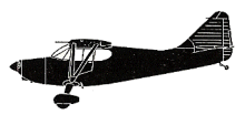
| Type: |  Stinson 108 |
| Owner/operator: | Larry D. Misenhelder |
| Registration: | N97684 |
| MSN: | 108-684 |
| Engine model: | FRANKLIN 6A4150-3 |
| Fatalities: | Fatalities: 0 / Occupants: 2 |
| Aircraft damage: | Destroyed |
| Category: | Accident |
| Location: | Spanishburg, WV -
 United States of America United States of America
|
| Phase: | Unknown |
| Nature: | Private |
| Departure airport: | Statesville, NC |
| Mercer County, WV | |
| Investigating agency: | NTSB |
| Confidence Rating: |
DURING A CROSS COUNTRY FLIGHT FROM MYRTLE BEACH, SOUTH CAROLINA TO CLARKSBURG, WEST VIRGINIA, THE NON-INSTRUMENT RATED PRIVATE PILOT DESCENDED THROUGH AN OVERCAST AND COLLIDED WITH TREES. THE PILOT STATED THAT HE HAD OBTAINED A COMPUTER RADAR WEATHER REPORT IN STATESVILLE, NORTH CAROLINA, WHICH WAS REPORTING 4500 FEET CEILING AND 20 MILES VISIBILITY. ACCORDING TO THE FAA, WHILE EN ROUTE TO HIS DESTINATION, THE PILOT CLIMBED AS HIGH AS 9000 FEET TO AVOID THE CLOUDS. AFTER CROSSING THE FIRST MOUNTAIN RIDGE, HE DESCENDED TO 500 FEET. HE STATED THAT HE SLOWED THE AIRCRAFT TO 70 KNOTS AND CONTINUED HIS DESCENT SO AS TO REGAIN SIGHT OF THE GROUND. THE NEAREST WEATHER STATION, ABOUT 10 MILES AWAY, REPORTED THE WEATHER AS OBSCURED SKY AND ONE-EIGHT OF A MILE VISIBILITY IN LIGHT DRIZZLE AND FOG.
Probable Cause: THE PILOT'S INTENTIONAL FLIGHT INTO INSTRUMENT METEOROLOGICAL CONDITIONS. CONTRIBUTING TO THE ACCIDENT WAS THE LOW CEILING IN CONJUNCTION WITH THE MOUNTAINOUS TERRAIN AND THE PILOT'S OVER CONFIDENCE.
Accident investigation:
 |
|
Sources:
NTSB BFO92LA007
Location
Revision history:
| Date/time | Contributor | Updates |
|---|---|---|
| 21-Dec-2016 19:25 | ASN Update Bot | Updated [Time, Damage, Category, Investigating agency] |
| 11-Apr-2024 11:08 | ASN Update Bot | Updated [Time, Other fatalities, Phase, Departure airport, Destination airport, Source, Narrative, Category, Accident report] |
Corrections or additions? ... Edit this accident description
The Aviation Safety Network is an exclusive service provided by:


 ©2024 Flight Safety Foundation