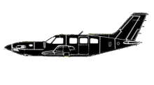
ASN Wikibase Occurrence # 162598
This information is added by users of ASN. Neither ASN nor the Flight Safety Foundation are responsible for the completeness or correctness of this information.
If you feel this information is incomplete or incorrect, you can submit corrected information.
| Date: | Monday 2 December 2013 |
| Time: | 19:19 |
| Type: |  Piper PA-46-310P Malibu JetPROP DLX |
| Owner/operator: | Culbair Llc |
| Registration: | N87NF |
| MSN: | 4608099/5 |
| Year of manufacture: | 1987 |
| Total airframe hrs: | 5904 hours |
| Engine model: | Pratt & Whitney PT6A-34 |
| Fatalities: | Fatalities: 1 / Occupants: 1 |
| Aircraft damage: | Destroyed |
| Category: | Accident |
| Location: | NE of Dawsonville, GA -
 United States of America United States of America
|
| Phase: | En route |
| Nature: | Private |
| Departure airport: | Morristown, NJ (MMU) |
| Atlanta, GA (PDK) | |
| Investigating agency: | NTSB |
| Confidence Rating: |
The pilot filed an instrument flight rules flight plan for the flight and was communicating with an air route traffic control center controller en route. The controller verified that the pilot had the local weather information for the intended destination and then he queried the pilot about the airplane’s heading (which was north of the direct heading), and the pilot reported that he was having trouble with the autopilot. He then asked the pilot if he was able to hold the assigned altitude of 8,000 ft mean sea level (msl), and the pilot responded that he could; however, the airplane descended below 8,000 ft msl, and the controller then issued an altitude of 7,000 ft msl and a heading of 200 degrees. There was no response from the pilot, and radar contact was lost. Shortly after, the airplane wreckage was found.
According to air traffic control radar data, the airplane turned left and then right before entering a descending left turn. A trajectory and performance study determined that, during the flight’s final 18 seconds, the airplane descended from about 8,000 to 2,200 ft msl, accelerated to about 300 knots indicated airspeed, and then broke up. According to the Pilot’s Operating Handbook, the airplane’s maximum operating limit speed was 172 knots.
Examinations of the airframe, engines, and autopilot revealed no preimpact mechanical malfunctions that would have precluded normal operations, and there was no evidence of medical impairment that would have affected the pilot’s performance. The pilot held an instrument rating; however, investigators were unable to determine the extent of the pilot’s recent night or instrument flight experience.
Although postaccident testing did not reveal any anomalies with the autopilot system, the pilot should have been able to disable the autopilot if it was experiencing a problem and then continue to fly the airplane. However, given the available data and his conversation with the controller, it is likely that the pilot became focused on the autopilot system and diagnosing the reported problem. Dark (moonless) night conditions prevailed for the flight, and, about the time of the accident, instrument meteorological conditions with restricted visibility due to rain prevailed. Given the pilot’s distraction, the weather conditions encountered during the flight, and the sustained descending left turn, it is likely that the pilot experienced spatial disorientation and then lost control of the airplane.
Probable Cause: The pilot’s in-flight loss of airplane control due to spatial disorientation while operating in dark night instrument meteorological conditions, which resulted in the exceedance of the airplane’s design stress limitations and a subsequent in-flight breakup. Contributing to the accident was the pilot’s distraction by the reported malfunction of the autopilot system.
Accident investigation:
 |
|
Sources:
NTSB
https://flightaware.com/live/flight/N87NF
Location
Revision history:
| Date/time | Contributor | Updates |
|---|---|---|
| 03-Dec-2013 03:41 | Geno | Added |
| 03-Dec-2013 03:54 | Geno | Updated [Aircraft type, Registration, Cn, Operator, Departure airport, Destination airport, Source, Narrative] |
| 03-Dec-2013 03:56 | Geno | Updated [Location] |
| 03-Dec-2013 16:03 | cloudsurfer89 | Updated [Total occupants, Narrative] |
| 03-Dec-2013 20:14 | Geno | Updated [Source, Damage] |
| 04-Dec-2013 06:31 | RyanVHS | Updated [Destination airport] |
| 08-Dec-2013 07:33 | Anon. | Updated [Aircraft type, Source] |
| 14-Dec-2013 07:19 | Geno | Updated [Phase, Nature, Source, Narrative] |
| 04-Jan-2016 17:52 | Aerossurance | Updated [Source, Narrative] |
| 21-Dec-2016 19:28 | ASN Update Bot | Updated [Time, Damage, Category, Investigating agency] |
| 29-Nov-2017 09:28 | ASN Update Bot | Updated [Operator, Other fatalities, Departure airport, Destination airport, Source, Narrative] |
Corrections or additions? ... Edit this accident description
The Aviation Safety Network is an exclusive service provided by:


 ©2024 Flight Safety Foundation