ASN Wikibase Occurrence # 23459
This information is added by users of ASN. Neither ASN nor the Flight Safety Foundation are responsible for the completeness or correctness of this information.
If you feel this information is incomplete or incorrect, you can submit corrected information.
| Date: | Saturday 14 June 1997 |
| Time: | 09:45 |
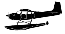
| Type: |  Cessna A185F Skywagon |
| Owner/operator: | |
| Registration: | N4758E |
| MSN: | 185-3864 |
| Fatalities: | Fatalities: 3 / Occupants: 3 |
| Aircraft damage: | Destroyed |
| Category: | Accident |
| Location: | Lac Morin, Quebec -
 Canada Canada
|
| Phase: | En route |
| Nature: | Private |
| Departure airport: | Lac Portneuf |
| Lac Sébastien | |
| Investigating agency: | TSB |
| Confidence Rating: |
The pilot and his two passengers flew to Lac Portneuf, Quebec, in the float-equipped Cessna A185F on 9 June for a fishing trip and had planned to return home to Pittsfield, Maine, on 13 June. The aircraft took off as scheduled on 13 June with a planned refuelling stop at Lac Sébastien, 51 nautical miles(nm) to the southwest; however, about 45 minutes after takeoff, the pilot returned to Lac Portneuf because fog and low visibility prevented him from reaching his destination. The pilot decided to put off the departure until the next day. On 14 June, the takeoff was delayed again because of fog and rain. About 0845 eastern daylight time (EDT), the pilot and his passengers eventually departed from Lac Portneuf on a visual flight rules (VFR) flight to Lac Sébastien. About 0930, two men in the area of the Monts Valin, about three miles west of Lac Morin, heard the sound of an aircraft engine pass overhead westbound and then the sound of an impact a few moments later. The witnesses reported that they did not see the aircraft fly overhead because the visibility was restricted by thick fog. The aircraft did not arrive at its destination at the estimated time as filed on the flight plan, and searches were undertaken. The aircraft was found at about 1330 on the same day by Search and Rescue (SAR). It crashed at the 2,500-foot level of the east side of a mountain rising to 2,650 feet above sea level (asl) in straight-and-level flight on a magnetic heading of 250 degrees. The seaplane was destroyed by the impact and fire. The pilot and the two passengers were killed instantly.
The pilot continued his flight in adverse weather conditions and probably did not have the necessary visual references to avoid hitting the steep slope of the mountain. Likely contributing to this occurrence was the pilot's reliance on GPS and not the navigation chart while attempting to maintain VMC.
Accident investigation:
 |
|
Sources:
1997Q0204
http://web.archive.org/web/20041121214841/http://www.tsb.gc.ca:80/en/reports/air/1997/a97q0118/a97q0118.asp
Revision history:
| Date/time | Contributor | Updates |
|---|---|---|
| 27-Sep-2008 01:00 | ASN archive | Added |
| 21-Dec-2016 19:14 | ASN Update Bot | Updated [Time, Damage, Category, Investigating agency] |
| 21-Dec-2016 19:16 | ASN Update Bot | Updated [Time, Damage, Category, Investigating agency] |
| 21-Dec-2016 19:20 | ASN Update Bot | Updated [Time, Damage, Category, Investigating agency] |
Corrections or additions? ... Edit this accident description
The Aviation Safety Network is an exclusive service provided by:


 ©2024 Flight Safety Foundation