ASN Wikibase Occurrence # 24874
This information is added by users of ASN. Neither ASN nor the Flight Safety Foundation are responsible for the completeness or correctness of this information.
If you feel this information is incomplete or incorrect, you can submit corrected information.
| Date: | Saturday 1 March 2003 |
| Time: | 14:45 |
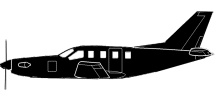
| Type: |  Socata TBM700 |
| Owner/operator: | High Performance Technologies Inc |
| Registration: | N700PP |
| MSN: | 59 |
| Year of manufacture: | 1992 |
| Total airframe hrs: | 1049 hours |
| Fatalities: | Fatalities: 3 / Occupants: 3 |
| Aircraft damage: | Substantial |
| Category: | Accident |
| Location: | near Leesburg Executive Airport (JYO/KJYO), VA -
 United States of America United States of America
|
| Phase: | Approach |
| Nature: | Executive |
| Departure airport: | Greenville-Spartanburg Airport, SC (GSP/KGSP) |
| Leesburg Executive Airport, VA (JYO/KJYO) | |
| Investigating agency: | NTSB |
| Confidence Rating: |
On March 1, 2003, about 1445 eastern standard time, a Socata TBM-700, N700PP, was substantially damaged when it collided with trees, during an instrument approach to Leesburg Executive Airport (JYO), Leesburg, Virginia. The certificated airline transport pilot, the private pilot, and the passenger were fatally injured. The airplane was owned and operated by High Performance Technologies, Incorporated, Arlington, Virginia. An instrument flight rules (IFR) flight plan was filed for the flight that originated at Greenville-Spartanburg International Airport (GSP), Greer, South Carolina, about 1230. Instrument meteorological conditions prevailed for the business flight conducted under 14 Code of Federal Regulations Part 91.
The private pilot, who sat in the left seat, was executing the LOC RWY 17 instrument approach in actual instrument meteorological conditions, when the airplane decelerated, lost altitude, and began a left turn about 2 miles from the airport. Subsequently, the airplane collided with terrain and came to rest on residential property. The radar data also indicated that the airplane was never stabilized on the approach. A witness, a private pilot, said the airplane "appeared" out of the fog about 300-400 feet above the ground. It was in a left bank, with the nose pointed down, and was traveling fast. The airplane then "simultaneously and suddenly level[ed] out," pitched up, and the engine power increased. The witness thought that the pilot realized he was low and was trying to "get out of there." The airplane descended in a nose-high attitude, about 65 degrees, toward the trees. Radar data indicates that the airplane slowed to 80 knots about 3 miles from the airplane, and then to 68 knots 18 seconds later as the airplane began to turn to the left. Examination of the airplane and engine revealed no mechanical deficiencies. Weather reported at the airport 25 minutes before the accident included wind from 140 degrees at 5 knots, visibility 1 statute mile, and ceiling 500 foot overcast. Weather 5 minutes before the accident included wind from 140 degrees at 5 knots, visibility 1 statute miles, and ceiling 300 foot overcast.
Probable Cause: The pilot's failure to fly a stabilized, published instrument approach procedure, and his failure to maintain adequate airspeed which led to an aerodynamic stall.
Accident investigation:
 |
|
Sources:
NTSB: https://www.ntsb.gov/_layouts/ntsb.aviation/brief.aspx?ev_id=20030310X00310&key=1
Location
Images:


Photos: NTSB
Revision history:
| Date/time | Contributor | Updates |
|---|---|---|
| 27-Sep-2008 01:00 | ASN archive | Added |
| 10-Mar-2014 21:15 | wf | Updated [Cn, Location, Phase, Destination airport, Source, Narrative] |
| 30-Jul-2016 23:28 | Dr.John Smith | Updated [Time, Operator, Location, Phase, Nature, Departure airport, Destination airport, Source, Narrative] |
| 30-Jul-2016 23:29 | Dr.John Smith | Updated [Narrative] |
| 21-Dec-2016 19:14 | ASN Update Bot | Updated [Time, Damage, Category, Investigating agency] |
| 21-Dec-2016 19:16 | ASN Update Bot | Updated [Time, Damage, Category, Investigating agency] |
| 21-Dec-2016 19:20 | ASN Update Bot | Updated [Time, Damage, Category, Investigating agency] |
| 25-Apr-2017 09:29 | TB | Updated [Location, Departure airport, Destination airport, Source, Damage] |
| 08-Dec-2017 18:26 | ASN Update Bot | Updated [Nature, Departure airport, Destination airport, Source, Damage, Narrative] |
| 27-Aug-2018 16:09 | wf | Updated [Damage] |
Corrections or additions? ... Edit this accident description
The Aviation Safety Network is an exclusive service provided by:


 ©2024 Flight Safety Foundation