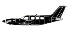
ASN Wikibase Occurrence # 43762
This information is added by users of ASN. Neither ASN nor the Flight Safety Foundation are responsible for the completeness or correctness of this information.
If you feel this information is incomplete or incorrect, you can submit corrected information.
| Date: | Thursday 28 June 2007 |
| Time: | 08:15 |
| Type: |  Piper PA-46-500TP Malibu Meridian |
| Owner/operator: | Private |
| Registration: | N477MD |
| MSN: | 4697264 |
| Year of manufacture: | 2006 |
| Total airframe hrs: | 201 hours |
| Fatalities: | Fatalities: 3 / Occupants: 3 |
| Aircraft damage: | Destroyed |
| Category: | Accident |
| Location: | Wellsville, MO -
 United States of America United States of America
|
| Phase: | Initial climb |
| Nature: | Private |
| Departure airport: | ST LOUIS, MO (SUS) |
| Buffalo, MN (CFE) | |
| Investigating agency: | NTSB |
| Confidence Rating: |
The pilot, before departure, obtained a weather briefing that indicated there were thunderstorms and areas of heavy precipitation along the route of flight. The pilot told the briefer that the airplane was equipped with onboard radar for weather avoidance. After takeoff, the pilot received two adverse weather advisories from the departure air traffic controller. The pilot acknowledged, requested and was cleared for course deviations to avoid the weather. The pilot was subsequently told to contact an en route traffic control center. The pilot did not request an update on, nor was he advised of, any additional adverse weather after switching over. Avionics data recovered from the wreckage showed the airplane encountered decreasing outside air temperatures (OAT) during the en route climb to a cruise altitude. The OAT decreased below freezing as the airplane climbed through 15,900 feet mean sea level. The primary flight display's (PFD) airspeed data decreased from about 140 knots indicated airspeed (KIAS) to 0 KIAS. During the loss of airspeed, the airplane's recorded climb rate decreased and the airplane entered a left turn. At this point, the en route controller asked the pilot if he had been given a clearance to deviate around weather. The pilot responded, "mike delta we've got problems uh... ." There were no additional communications received from the pilot and radar contact with the airplane was lost shortly thereafter. The recovered PFD data indicated that the airplane exceeded its maximum structural operating speed during a rapid descent. In the descent, the airplane reached a ground speed of 250 knots and vertical loads reaching 5g. The recovered data and witness marks from the right wing indicated the airplane sustained an in-flight breakup after exceeding the airplane's maximum load factor limit. A review of the available weather data indicated that there was an area of extreme precipitation associated with thunderstorms east of the accident site and that the airplane was likely in instrument meteorological conditions at the time of the upset. An on-scene investigation did not reveal any pre-impact anomalies with the airplane and its related systems. Analysis of the recovered PFD and Multi-Function Display (MFD) data indicated that the pilot did not utilize the available pitot tube heat that would have afforded ice protection. Recovered PFD/MFD data, along with a weather analysis, indicated that the airplane was operating in an environment conducive for pitot tube icing. Additionally, recovered data showed airspeeds were recorded during the rapid descent at altitudes lower than the observed freezing level. The before takeoff checklist indicated, "Pitot Heat ... ON."
Probable Cause: The pilot's failure to activate the pitot heat as per the checklist, resulting in erroneous airspeed information due to pitot tube icing, and his subsequent failure to maintain aircraft control. Contributing to the accident was the pilot's continued flight in an area of known adverse weather.
Accident investigation:
 |
|
Sources:
NTSB: https://www.ntsb.gov/_layouts/ntsb.aviation/brief.aspx?ev_id=20070705X00878&key=1
Location
Images:

(c) NTSB

(c) NTSB
Revision history:
| Date/time | Contributor | Updates |
|---|---|---|
| 28-Oct-2008 00:45 | ASN archive | Added |
| 06-Aug-2009 22:35 | Anon. | Updated |
| 06-Aug-2009 22:36 | harro | Updated |
| 22-Sep-2009 11:01 | harro | Updated |
| 22-Sep-2009 11:02 | harro | Updated |
| 21-Dec-2016 19:24 | ASN Update Bot | Updated [Time, Damage, Category, Investigating agency] |
| 04-Dec-2017 18:41 | ASN Update Bot | Updated [Cn, Operator, Other fatalities, Destination airport, Source, Narrative] |
Corrections or additions? ... Edit this accident description
The Aviation Safety Network is an exclusive service provided by:


 ©2024 Flight Safety Foundation