ASN Wikibase Occurrence # 44589
This information is added by users of ASN. Neither ASN nor the Flight Safety Foundation are responsible for the completeness or correctness of this information.
If you feel this information is incomplete or incorrect, you can submit corrected information.
| Date: | Tuesday 11 January 2005 |
| Time: | 21:45 |
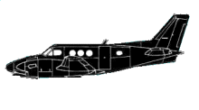
| Type: |  Beechcraft E90 King Air |
| Owner/operator: | Mountain Flight Service opb Yampa Valley Air Ambulance |
| Registration: | N41WE |
| MSN: | LW-280 |
| Year of manufacture: | 1978 |
| Total airframe hrs: | 8921 hours |
| Fatalities: | Fatalities: 3 / Occupants: 4 |
| Aircraft damage: | Destroyed |
| Category: | Accident |
| Location: | Rawlins, WY -
 United States of America United States of America
|
| Phase: | Approach |
| Nature: | Ferry/positioning |
| Departure airport: | Steamboat Springs Airport, CO (SBS/KSBS) |
| Rawlins Airport, WY (RWL/KRWL) | |
| Investigating agency: | NTSB |
| Confidence Rating: |
On January 11, 2005, approximately 2145 mountain standard time, a Beech E-90, N41WE, operating as Yampa Valley Air Ambulance, was destroyed when it impacted terrain while flying the VOR/GPS approach to runway 22 at Rawlins Municipal Airport/Harvey Field (RWL), Rawlins, Wyoming. The airline transport pilot (ATP) and two flight nurses were killed, and the flight paramedic was seriously injured. The airplane was owned and operated by Mountain Flight Service, Inc., of Steamboat Springs, Colorado. Night instrument meteorological conditions (IMC) prevailed at the time of the accident. The emergency medical services (EMS) repositioning flight was being conducted on an instrument flight rules flight plan under the provisions of 14 Code of Federal Regulation Part 91. The cross-country flight originated at Steamboat Springs, Colorado, about 2116.
The air ambulance was dispatched from Steamboat Springs, Colorado (SBS), to pick up and transport a patient in serious condition from Rawlins Municipal Airport/Harvey Field (RWL) to Casper, Wyoming. Approaching RWL, the pilot initiated a right turn outbound to maneuver for the final approach course of the VOR/GPS approach to runway 22. On the inbound course to the airport, the airplane impacted mountainous terrain, approximately 2.5 nautical miles east-northeast of the airport. The airplane, configured for landing, struck the terrain wings level, in a 45-degree nose-down dive, consistent with impact following an aerodynamic stall. Approximately 5 minutes before the accident, RWL reported broken ceilings at 1,100 and 1,800 feet above ground level (agl), 3,100 feet agl overcast, visibility 2.5 statute miles with light snow and mist, temperature 33 degrees Fahrenheit (F), dew point 30 degrees F, winds 240 degrees at 3 knots, and altimeter 29.35 inches. Before departing SBS, the pilot received a weather briefing from Denver Flight Service. The briefer told the pilot that there was a band of light to moderate snow shower activity half way between Rock Springs and Rawlins, spreading to the northeast. The briefer told the pilot there were adverse conditions and flight precautions along his route for occasional mountain or terrain obscurations. The pilot responded that he planned to fly instrument flight rules for the entire flight. The National Weather Service, Surface Analysis showed a north-south stationary front positioned along the front range of the Rocky Mountains beginning at the Wyoming/Montana border and extending south into north-central Colorado. Station plots indicated patchy snow over western Colorado and Wyoming. The most recent AIRMET reported, "Occasional moderate rime or mixed icing in clouds and precipitation between the freezing level and flight level 220." The freezing level for the area encompassing the route of flight began at the surface. Witnesses in the vicinity of RWL reported surface weather conditions varying from freezing rain to heavy snow. An examination of the airplane showed clear ice up to 1 ½ inches thick adhering to the vertical stabilizer, the left and right wings, the right main landing gear tire, and the right propeller. The airplane's aerodynamic performance was degraded due to the ice contamination, leading to a stall. An examination of the airplane's systems revealed no anomalies. A human factors review of interviews and other materials showed insufficient evidence that the company placed pressure on the pilot to take the flight; however, the review did not rule out the pilot inducing pressure on himself. FAA Advisory Circular (AC) 135-15, Emergency Medical Services/Airplane (EMS/A) addresses several subject areas not practiced by the operator, including, "Additional considerations when planning IFR flights include the following: (1) Avoid flight in icing weather whenever possible."
Probable Cause: The pilot's inadvertent flight into adverse weather [severe icing] conditions, resulting in an aerodynamic stall impact with rising, mountainous terrain during approach. A factor contributing to the accident was the pilot's inadequate planning for the forecasted icing conditions.
Accident investigation:
 |
|
Sources:
NTSB: https://www.ntsb.gov/_layouts/ntsb.aviation/brief.aspx?ev_id=20050118X00064&key=1
Location
Images:


Photos: NTSB
Revision history:
| Date/time | Contributor | Updates |
|---|---|---|
| 28-Oct-2008 00:45 | ASN archive | Added |
| 07-Feb-2009 10:38 | harro | Updated |
| 21-Dec-2016 19:24 | ASN Update Bot | Updated [Time, Damage, Category, Investigating agency] |
| 06-Dec-2017 06:51 | ASN Update Bot | Updated [Other fatalities, Nature, Source, Narrative] |
Corrections or additions? ... Edit this accident description
The Aviation Safety Network is an exclusive service provided by:


 ©2024 Flight Safety Foundation