ASN Wikibase Occurrence # 721
This information is added by users of ASN. Neither ASN nor the Flight Safety Foundation are responsible for the completeness or correctness of this information.
If you feel this information is incomplete or incorrect, you can submit corrected information.
| Date: | Friday 6 February 1998 |
| Time: | 09:00 |
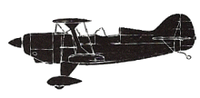
| Type: |  Pitts S-2A |
| Owner/operator: | Private |
| Registration: | VH-DAF |
| MSN: | 2224 |
| Fatalities: | Fatalities: 2 / Occupants: 2 |
| Aircraft damage: | Destroyed |
| Category: | Accident |
| Location: | Floraville Station, QLD -
 Australia Australia
|
| Phase: | En route |
| Nature: | Private |
| Departure airport: | Proa Station, Queensland |
| Burketown, Queensland | |
| Investigating agency: | BASI |
| Confidence Rating: |
A mains power failure affected several properties along the Leichhardt River. The Far North Queensland Electricity Board (FNQEB) chartered a helicopter to conduct an aerial patrol along the affected power line. At about 15:30 the pilot of the helicopter found a break in a single wire earth return (SWER) line to Floraville station homestead where it crossed the Leichhardt River.
Debris, later identified as parts of a Pitts Special aircraft, was found downstream from the break. A 280 metre span aligned 080/260 degrees had been breached. The broken ends were flung into trees on the banks of the river.
Several days later, the wreckage of the aircraft was located by police divers. It had come to rest upside down in about 6 metres of water, approximately 160 metres downstream from, and north of the wire strike. Both persons on board (pilot and passenger) were killed
Examination of the aircraft revealed that it was banked approximately 15 degrees right wing low
when it struck the power line from a southerly direction. The left top wing had been torn from the
aircraft
The broken span was located near a 20 degree right bend in the river. It was 280 metres long, aligned 080/260 degrees, and hanging approximately 10 metres above the water. The line was suspended below the level of the tops of the trees on the riverbank. Viewed from the south, the old, oxidised wire was difficult to see against the background.
The power poles were positioned away from the riverbanks amongst trees. They, too, were difficult
to see. The distance of the aircraft wreckage from the point of impact with the wire, and the position of the broken ends of the wire, are indicative of a high speed impact.
The homestead was serviced by a gravel air strip aligned north/south, parallel to the reach of the
river where the aircraft was found. The southern threshold was approximately 800 metres north-west of the wire strike. The airstrip was not visible from the level of the power line across the river. The local weather at the time of the accident was fine with a clear sky.
Accident investigation:
 |
|
Sources:
1. http://www.atsb.gov.au/publications/investigation_reports/1998/aair/aair199800344.aspx
2. http://www.atsb.gov.au/media/24992/ASOR199800344.pdf
Revision history:
| Date/time | Contributor | Updates |
|---|---|---|
| 21-Jan-2008 10:00 | ASN archive | Added |
| 13-Aug-2008 11:15 | RobertMB | Updated |
| 12-Apr-2012 15:18 | Dr. John Smith | Updated [Time, Operator, Total fatalities, Total occupants, Other fatalities, Location, Phase, Nature, Departure airport, Destination airport, Source, Damage, Narrative] |
| 15-Apr-2014 18:52 | Dr. John Smith | Updated [Time, Total fatalities, Total occupants, Departure airport, Destination airport, Source, Narrative] |
| 10-Jun-2022 04:48 | Ron Averes | Updated [Location] |
Corrections or additions? ... Edit this accident description
The Aviation Safety Network is an exclusive service provided by:


 ©2024 Flight Safety Foundation