ASN Wikibase Occurrence # 329746
| Date: | Thursday 26 December 1974 |
| Time: | 18:05 |
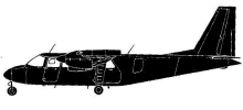
| Type: |  Britten-Norman BN-2A Islander |
| Owner/operator: | Harbor Airlines |
| Registration: | N66HA |
| MSN: | 31 |
| Year of manufacture: | 1968 |
| Fatalities: | Fatalities: 4 / Occupants: 6 |
| Aircraft damage: | Destroyed, written off |
| Category: | Accident |
| Location: | ca 1 km N of Seattle/Tacoma International Airport, WA (SEA) -
 United States of America United States of America
|
| Phase: | Initial climb |
| Nature: | Passenger - Scheduled |
| Departure airport: | Seattle/Tacoma International Airport, WA (SEA/KSEA) |
| Oak Harbor Airport, WA (ODW/KOKH) | |
| Investigating agency: | NTSB |
| Confidence Rating: |
Visibility was poor due to snowfall when the Islander departed Tacoma Airport for Oak Harbor. Shortly after takeoff the airplane collided with terrain in the residential area of Riverton Heights, WA. Unknown matter in the pitot tube had caused unreliable readings of the airspeed indicator.
PROBABLE CAUSE:
pilot in command - diverted attention from operation of aircraft
miscellaneous acts,conditions - instruments-misread or failed to read
FACTORS:
weather - low ceiling
weather - snow
terrain - high obstructions
instruments/equipment and accessories - flight and navigation instruments: airspeed
miscellaneous acts,conditions - obstructed
miscellaneous - foreign material affecting normal operations
Accident investigation:
|
Sources:
BAAA-ACRO
NTSB
Thomas Brügge
World Directory of Airliner Crashes
Location
Revision history:
| Date/time | Contributor | Updates |
|---|
The Aviation Safety Network is an exclusive service provided by:


 ©2024 Flight Safety Foundation