ASN Wikibase Occurrence # 324014
| Date: | Thursday 5 March 1998 |
| Time: | 05:20 |
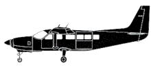
| Type: |  Cessna 208B Super Cargomaster |
| Owner/operator: | Baron Aviation |
| Registration: | N840FE |
| MSN: | 208B0142 |
| Year of manufacture: | 1988 |
| Total airframe hrs: | 4079 hours |
| Engine model: | Pratt & Whitney Canada PT6A-114 |
| Fatalities: | Fatalities: 1 / Occupants: 1 |
| Aircraft damage: | Destroyed, written off |
| Category: | Accident |
| Location: | 14 km ESE of Clarksville, TN -
 United States of America United States of America
|
| Phase: | En route |
| Nature: | Cargo |
| Departure airport: | Memphis International Airport, TN (MEM/KMEM) |
| Bowling Green-Warren County Airport, KY (BWG/KBWG) | |
| Investigating agency: | NTSB |
| Confidence Rating: |
Flight 8315 departed Memphis (MEM) at 04:13 for a cargo flight to Bowling Green, KY. The aircraft was flying level at an altitude of about 9000 feet, on the Nashville VOR 315-degree radial, about 25 nm (46 km), when radio and radar contact was lost. It appeared that the Caravan had experienced a slow reduction of airspeed from 135 knots to 102 kts in the final 8 minutes of flight at altitude, and then abruptly exhibited a sharp nose down pitch attitude with a rapid increase in airspeed. The airplane impacted on a downward slope (20-25 deg) of a small ridge that formed the northern side of a valley that ran east-west, at an elevation of about 470 feet.
PROBABLE CAUSE: "The pilot did not maintain control of the airplane due to undetected airframe ice, resulting in an inadvertent stall, and subsequent impact with the ground. Factors in this accident were; flight into clouds, below freezing temperatures, and the inability of the pilot to detect ice, due to the lack of an ice detection system to determine ice build up on portions of the airframe that are not visible from the cockpit. "
Accident investigation:
 |
|
Sources:
ICAO Adrep Summary 3/98 (#52)
NTSB
Location
Revision history:
| Date/time | Contributor | Updates |
|---|
The Aviation Safety Network is an exclusive service provided by:


 ©2024 Flight Safety Foundation