ASN Wikibase Occurrence # 323605
| Date: | Thursday 23 December 1999 |
| Time: | 16:00 |
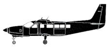
| Type: |  Cessna 208B Grand Caravan |
| Owner/operator: | M&N Aviation |
| Registration: | N1315A |
| MSN: | 208B0655 |
| Year of manufacture: | 1998 |
| Total airframe hrs: | 1427 hours |
| Engine model: | Pratt & Whitney Canada PT6A-114A |
| Fatalities: | Fatalities: 0 / Occupants: 2 |
| Aircraft damage: | Destroyed, written off |
| Category: | Accident |
| Location: | near Adjuntas -
 Puerto Rico Puerto Rico
|
| Phase: | En route |
| Nature: | Passenger - Non-Scheduled/charter/Air Taxi |
| Departure airport: | Ponce-Mercedita Airport (PSE/TJPS) |
| Aguadilla-Borinquen Airport (BQN/TJBQ) | |
| Investigating agency: | NTSB |
| Confidence Rating: |
The Cessna Caravan departed Ponce (PSE) at 15:26 without filing a flight plan. The flight was about 30 miles (48 km) north west of Ponce when low clouds and heavy turbulence were encountered. The airplane collided with trees as the pilot maneuvered to maintain visual conditions. The terrain elevation at the approximate location of the accident site was 2500 feet.
PROBABLE CAUSE: "The pilot continued flight into adverse weather conditions that included low ceiling and turbulence. Factors to the accident were trees."
Accident investigation:
 |
|
Sources:
NTSB
Location
Images:

photo (c) via Werner Fischdick; Berlin-Schönefeld Airport (SXF/EDDB); May 1998
Revision history:
| Date/time | Contributor | Updates |
|---|
The Aviation Safety Network is an exclusive service provided by:


 ©2024 Flight Safety Foundation