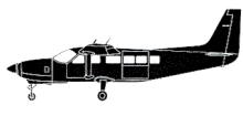
ASN Wikibase Occurrence # 323424
| Date: | Saturday 23 September 2000 |
| Time: | 19:50 |
| Type: |  Cessna 208B Super Cargomaster |
| Owner/operator: | Telford Aviation |
| Registration: | N590TA |
| MSN: | 208B0590 |
| Year of manufacture: | 1997 |
| Total airframe hrs: | 2671 hours |
| Engine model: | Pratt & Whitney Canada PT6A-114A |
| Fatalities: | Fatalities: 0 / Occupants: 1 |
| Aircraft damage: | Substantial, repaired |
| Category: | Accident |
| Location: | 3,2 km NW of Greenville, ME -
 United States of America United States of America
|
| Phase: | Approach |
| Nature: | Cargo |
| Departure airport: | Bangor International Airport, ME (BGR/KBGR) |
| Greenville Municipal Airport, ME | |
| Investigating agency: | NTSB |
| Confidence Rating: |
The pilot was performing a GPS runway 14 approach to Greenville, and descended below the minimum descent altitude when he believed he had the runway environment in sight. When the pilot realized he was not near the runway, he added full power and attempted to climb; however, the airplane struck rising terrain about 2 miles northwest of the airport. The airport was located at an elevation of 1,400 feet, and the airplane impacted terrain at an elevation of approximately 1,200 feet. According to the GPS runway 14 approach procedure, the minimum descent altitude was 2,300 feet.
PROBABLE CAUSE: "The pilot's improper in-flight decision to continue his descent without visual contact with the runway, and his inattention to his altitude, in relation to the airport elevation."
Accident investigation:
 |
|
Sources:
NTSB
History of this aircraft
Other occurrences involving this aircraft
| 8 August 2015 | VH-LNH | Aviair | 0 | near Kununurra Airport, WA |  |
min |
| 16 November 2016 | VH-LNH | Aviair Pty Ltd | 0 | 9 km north of Solomon, WA |  |
min |
Location
Revision history:
| Date/time | Contributor | Updates |
|---|
The Aviation Safety Network is an exclusive service provided by:


 ©2024 Flight Safety Foundation