ASN Wikibase Occurrence # 319685
| Date: | Wednesday 11 April 2018 |
| Time: | 08:18 |
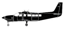
| Type: |  Cessna 208B Grand Caravan |
| Owner/operator: | Hageland Aviation Services |
| Registration: | N814GV |
| MSN: | 208B0958 |
| Year of manufacture: | 2002 |
| Total airframe hrs: | 9778 hours |
| Engine model: | Pratt & Whitney Canada PT6A-114A |
| Fatalities: | Fatalities: 0 / Occupants: 1 |
| Aircraft damage: | Substantial, written off |
| Category: | Accident |
| Location: | 3,2 km N of Atqasuk Airport, AK (ATK) -
 United States of America United States of America
|
| Phase: | Approach |
| Nature: | Cargo |
| Departure airport: | Utqiagvik-Wiley Post/Will Rogers Memorial Airport, AK (BRW/PABR) |
| Atqasuk Airport, AK (ATK/PATQ) | |
| Investigating agency: | NTSB |
| Confidence Rating: |
The Cessna 208B airplane, N814GV, impacted snow-covered terrain about two miles north of the Atqasuk Airport, Alaska. The pilot, the only occupant onboard, sustained minor injuries, and the airplane sustained substantial damage. The airplane was being operated by Hageland Aviation Services, Inc., as a Ravn Connect cargo/mail flight. The flight originated about 07:58, from the Utqiagvik (formerly Barrow) Airport, Alaska, and it was destined for Atqasuk, which is located about 58 miles south.
The area between Utqiagvik and Atqasuk consists of remote, flat, featureless, tundra-covered terrain, which is snow-covered in April.
Weather conditions at the time of departure consisted of clear skies, 9 miles visibility, and a light wind. After takeoff, the airplane climbed to 2,500 feet msl, and proceeded southbound towards Atqasuk. The pilot said that as the airplane neared Atqasuk, with the autopilot engaged, the airplane descended to about 1,500 feet msl, but then he noticed an area of low fog around Atqasuk. He said that when the airplane was about two miles from the airport, he heard the audible autopilot disengagement annunciator tone sound, which was immediately followed by the pilot's control column pitching forward. The pilot said that he was unable to pull the control column back, and the airplane subsequently descended into instrument meteorological conditions. He said that the airplane continued to descend into the fog, then it struck the snow-covered tundra, and nosed over. The airplane sustained substantial damage to the wings, fuselage, and empennage.
A North Slope Borough Search and Rescue helicopter pilot told the NTSB that while en route from Utqiagvik to the accident site he encountered ice fog, reduced visibility, and flat light conditions that made it difficult to discern topographical features on the snow-covered tundra. He noted that as the flight continued, both pilots noticed ice beginning to accumulate on the helicopter's windscreen, so the decision was made to abort the search and rescue flight, and the helicopter returned to Utqiagvik. A search team from Atqasuk eventually reached the accident site on snow machines and transported the pilot to Atqasuk.
Probable Cause and Findings:
The pilot's decision to continue a visual flight rules flight into an area of instrument meteorological conditions and his subsequent failure to level the airplane after the autopilot disconnected, which resulted in a collision with terrain.
Accident investigation:
 |
|
Sources:
KTVA
Flightaware
FAA
Location
Images:

photo (c) NTSB; near Atqasuk Airport, AK (ATK); April 2018; (publicdomain)

photo (c) NTSB; near Atqasuk Airport, AK (ATK); April 2018; (publicdomain)
Revision history:
| Date/time | Contributor | Updates |
|---|
The Aviation Safety Network is an exclusive service provided by:


 ©2024 Flight Safety Foundation