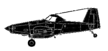
ASN Wikibase Occurrence # 122211
This information is added by users of ASN. Neither ASN nor the Flight Safety Foundation are responsible for the completeness or correctness of this information.
If you feel this information is incomplete or incorrect, you can submit corrected information.
| Date: | Monday 9 May 2011 |
| Time: | 09:15 |
| Type: |  Air Tractor AT-802A |
| Owner/operator: | Taylor Aviation Inc |
| Registration: | N8523H |
| MSN: | 802A-0162 |
| Year of manufacture: | 2003 |
| Total airframe hrs: | 1407 hours |
| Engine model: | P&W PT6A-67AG |
| Fatalities: | Fatalities: 1 / Occupants: 1 |
| Aircraft damage: | Substantial |
| Category: | Accident |
| Location: | About 11 miles east of Frank Wiley Field Airport - KMLS, Miles City, M -
 United States of America United States of America
|
| Phase: | En route |
| Nature: | Ferry/positioning |
| Departure airport: | Aberdeen, SD (ABR) |
| Miles City, MT | |
| Investigating agency: | NTSB |
| Confidence Rating: |
The instrument-rated pilot departed to reposition the airplane, which was configured for visual flight rules (VFR) operations only, to its base of operation about 316 miles northwest of the departure airport. Weather conditions at the departure airport were VFR, however, the destination airport and throughout the western portion of the route had deteriorating weather conditions and low cloud ceilings. There was no record of the pilot obtaining a weather brief for the flight; however, while filing a VFR flight plan, the pilot informed the weather briefer that he already had weather information and declined any additional weather information offered by the briefer. A witness located near the accident site heard the sound of an airplane flying low and fast from the east to the west past her home. Shortly after hearing the airplane, she heard a "poof" sound and immediately looked outside for the airplane. The witness stated that she did not see the airplane or any smoke in the area; however, she observed a cloud layer covering the top of the mountain ridge where the accident site was later located.
The global positioning system (GPS) track for the flight indicated that during the later portion of the flight, the airplane descended from an altitude of about 5,869 feet mean sea level (msl) to 3,054 feet msl, while conducting several course changes from the northwest to the southwest, most likely as a result of the pilot attempting to avoid or remain clear of the deteriorating weather conditions. The GPS data further showed a climb to an altitude of about 3,241 feet msl before turning left to a westerly heading. About 2 minutes later, the data showed a left turn to the southwest at an altitude of about 3,406 feet msl, where a descent was initiated. The last recorded data point was recorded at an altitude of about 3,284 feet msl. The accident site was located about 0.15 miles southwest of the last recorded GPS position at an elevation of about 3,077 feet msl.
A weather report in the area of the accident showed a visibility of 2 miles, mist, overcast cloud layer at 700 feet, and a variable ceiling from 400 feet to 1,100 feet.
Probable Cause: The pilot's continued visual flight rules flight into deteriorating weather conditions in an airplane not equipped for instrument flight, which resulted in a collision with terrain.
Accident investigation:
 |
|
Sources:
NTSB
Location
Revision history:
| Date/time | Contributor | Updates |
|---|---|---|
| 11-May-2011 03:12 | RobertMB | Added |
| 11-May-2011 05:21 | RobertMB | Updated [Aircraft type, Registration, Cn, Operator, Departure airport, Narrative] |
| 11-May-2011 08:11 | RobertMB | Updated [Date, Narrative] |
| 11-May-2011 10:26 | RobertMB | Updated [Time, Aircraft type, Registration, Cn, Operator, Nature, Narrative] |
| 09-May-2012 22:37 | Geno | Updated [Time, Location, Departure airport, Destination airport, Source, Narrative] |
| 21-Dec-2016 19:25 | ASN Update Bot | Updated [Time, Damage, Category, Investigating agency] |
| 27-Nov-2017 16:55 | ASN Update Bot | Updated [Operator, Other fatalities, Departure airport, Destination airport, Source, Narrative] |
Corrections or additions? ... Edit this accident description
The Aviation Safety Network is an exclusive service provided by:


 ©2024 Flight Safety Foundation