ASN Wikibase Occurrence # 134944
This information is added by users of ASN. Neither ASN nor the Flight Safety Foundation are responsible for the completeness or correctness of this information.
If you feel this information is incomplete or incorrect, you can submit corrected information.
| Date: | Monday 30 July 2007 |
| Time: | 09:00 |
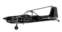
| Type: |  Cessna A188B |
| Owner/operator: | Private |
| Registration: | N9298R |
| MSN: | 18802224T |
| Year of manufacture: | 1975 |
| Total airframe hrs: | 4557 hours |
| Fatalities: | Fatalities: 0 / Occupants: 1 |
| Aircraft damage: | Destroyed |
| Category: | Accident |
| Location: | Garwood, TX -
 United States of America United States of America
|
| Phase: | Take off |
| Nature: | Agricultural |
| Departure airport: | Garwood, TX |
| Garwood, TX | |
| Investigating agency: | NTSB |
| Confidence Rating: |
The 1,457-hour commercial pilot lost control of the tailwheel-equipped agricultural airplane while attempting to depart from a 2,400-foot long unimproved private grass airstrip. The pilot reported that while departing on a southerly heading he was "dodging pot holes and mud holes" on the airstrip. The spray booms under the wings became entangled with tall grass resulting in a loss of directional control. The airplane exited the right side of the airstrip, the right wing collided with a fence post and the airplane "ran through a ditch." An FAA inspector interviewed the pilot, who confirmed the accident sequence. The inspector recorded structural damage. On the Airport Information block of the accident report form, the pilot categorized the runway as "dirt" and further described the condition of the runway as "holes," "rough," "soft," and "wet." At about 5 minutes after the mishap, the nearest weather reporting station, located 27-nautical miles to the south-east of the accident site, reported winds calm, visibility 5 statue miles with mist, temperature 84 degrees Fahrenheit, dew point 81 degrees Fahrenheit, and barometric pressure of 29.93 inches of Mercury. The density altitude was calculated at 1,776 feet.
Probable Cause: The pilot's failure to maintain proper clearance from terrain/obstacles. A contributing factor was the runway conditions.
Accident investigation:
 |
|
Sources:
NTSB: https://www.ntsb.gov/_layouts/ntsb.aviation/brief.aspx?ev_id=20070828X01248&key=1
Location
Revision history:
| Date/time | Contributor | Updates |
|---|---|---|
| 21-Dec-2016 19:26 | ASN Update Bot | Updated [Time, Damage, Category, Investigating agency] |
| 04-Dec-2017 18:45 | ASN Update Bot | Updated [Departure airport, Destination airport, Source, Narrative] |
Corrections or additions? ... Edit this accident description
The Aviation Safety Network is an exclusive service provided by:


 ©2024 Flight Safety Foundation