ASN Wikibase Occurrence # 44943
This information is added by users of ASN. Neither ASN nor the Flight Safety Foundation are responsible for the completeness or correctness of this information.
If you feel this information is incomplete or incorrect, you can submit corrected information.
| Date: | Saturday 31 January 2004 |
| Time: | 16:32 |
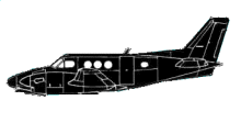
| Type: |  Beechcraft C90 King Air |
| Owner/operator: | Private |
| Registration: | N75GC |
| MSN: | LJ-727 |
| Year of manufacture: | 1977 |
| Total airframe hrs: | 8208 hours |
| Engine model: | Pratt & Whitney Canada PT6A-21 |
| Fatalities: | Fatalities: 2 / Occupants: 2 |
| Aircraft damage: | Destroyed |
| Category: | Accident |
| Location: | Homestead, FL -
 United States of America United States of America
|
| Phase: | Manoeuvring (airshow, firefighting, ag.ops.) |
| Nature: | Private |
| Departure airport: | Marathon, FL (KMTH) |
| Fort Lauderdale, FL (KFXE) | |
| Investigating agency: | NTSB |
| Confidence Rating: |
The instrument rated pilot received three weather briefings on the date of the accident from the Miami Automated Flight Service Station. The pilot obtained his IFR clearance while airborne, was advised to climb to 9000 feet mean sea level (MSL), then later advised to descend and maintain 2000 feet, and to fly heading 030 degrees. Radar data indicates that following the instruction from the controller, the airplane made a right descending turn to a southeasterly heading, followed by a left turn to an easterly heading where the airplane was lost from radar while at 2,200 feet mean sea level. The crash was located 138 degrees and .38 nautical mile from the last radar target. Between 1631:04, and 1631:16, the airplane descended from 7,600 to 6,100 feet. Between 1631:16, and the last radar target 12 seconds later at 1631:28, the airplane descended 3,900 feet. Weather radar data indicates the airplane encountered video integrator and processor (VIP) Level 2, or "moderate intensity" echoes in the area of the in-flight loss of control. Approximately 10 and 20 miles east-northeast through southeast of the accident site, maximum echoes of VIP Level 5 to 6, or "intends to extreme intensity" echoes were noted. The strongest reflectivities were located 20 miles east of the accident site. Disintegration of the airplane was noted; there was no evidence of in-flight, or post crash fire of any recovered components. The full span of the left wing, left aileron, left horizontal, and left elevator were accounted for. A section of the right wing and right outboard flap was identified; the right wing was fragmented. Examination of the engine and propellers revealed no evidence of preimpact failure or malfunction. No determination was made whether the pilot met the instrument recency of experience requirement of 14 CFR Part 61.57 (c).
Probable Cause: The pilot's inadequate in-flight planning/decision which resulted in an encounter with rain showers and turbulence, a loss of aircraft control, and overstress of the airframe.
Accident investigation:
 |
|
Sources:
NTSB: https://www.ntsb.gov/_layouts/ntsb.aviation/brief.aspx?ev_id=20040212X00188&key=1
Location
Revision history:
| Date/time | Contributor | Updates |
|---|---|---|
| 28-Oct-2008 00:45 | ASN archive | Added |
| 21-Dec-2016 19:24 | ASN Update Bot | Updated [Time, Damage, Category, Investigating agency] |
| 07-Dec-2017 17:35 | ASN Update Bot | Updated [Source, Narrative] |
Corrections or additions? ... Edit this accident description
The Aviation Safety Network is an exclusive service provided by:


 ©2024 Flight Safety Foundation