ASN Wikibase Occurrence # 35388
This information is added by users of ASN. Neither ASN nor the Flight Safety Foundation are responsible for the completeness or correctness of this information.
If you feel this information is incomplete or incorrect, you can submit corrected information.
| Date: | Monday 12 June 1995 |
| Time: | 11:16 LT |
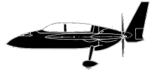
| Type: |  Rutan Long-EZ |
| Owner/operator: | Smith, David W. |
| Registration: | N86PD |
| MSN: | 1059 |
| Total airframe hrs: | 637 hours |
| Engine model: | Lycoming O-235-L2C |
| Fatalities: | Fatalities: 1 / Occupants: 2 |
| Aircraft damage: | Destroyed |
| Category: | Accident |
| Location: | Cloudcroft, NM -
 United States of America United States of America
|
| Phase: | Manoeuvring (airshow, firefighting, ag.ops.) |
| Nature: | Private |
| Departure airport: | Alamogordo, NM |
| Roswell, NM (KROW) | |
| Investigating agency: | NTSB |
| Confidence Rating: |
THE LINEMAN AT ALAMOGORDO AIRPORT REPORTED ADDING 28 GALLONS OF 100LL AVGAS TO THE FUEL TANKS. THE AIRCRAFT TOOK OFF WITH TWO MEN (APPROXIMATELY 195 POUNDS EACH PLUS PERSONAL ITEMS). THE AIRCRAFT WAS OBSERVED FLYING LOW OVER HIGH ROLLS, NEW MEXICO AND EAST TOWARDS PINEY WOODS, NEW MEXICO. WITNESSES IN PINEY WOODS REPORTED TO THE STATE POLICE THAT 'THE AIRCRAFT WAS CIRCLING SO LOW THAT THEY THOUGHT IT WAS GOING TO LAND.' THE AIRPLANE WAS NEXT OBSERVED AT THE TOP OF THE VALLEY IN THE MOUNTAIN PASS VILLAGE OF CLOUDCROFT, NEW MEXICO, WHERE A WITNESS REPORTED THAT IT OVERFLEW THE VILLAGE 'AT A VERY LOW ALTITUDE AND MISSED THE TOP OF MY BUILDING BY 30 FEET.' THE AIRPLANE WAS OBSERVED SEVERAL TIMES MAKING ABRUPT STEEP BANK HEADING CHANGES. ONE WITNESS REPORTED THAT 'THE PLANE WAS ON ITS SIDE AND THE WINGS WERE PERPENDICULAR TO THE GROUND.' THE AIRPLANE COLLIDED WITH A TALL PINE TREE AND SUBSEQUENTLY IMPACTED THE GROUND. THE ELEVATION AT THE ACCIDENT SITE WAS 8,665 FEET AND THE CALCULATED DENSITY ALTITUDE AT THE TIME OF THE ACCIDENT WAS 11,900 FEET.
Probable Cause: THE PILOT'S FAILURE TO MAINTAIN CLEARANCE FROM TREES. FACTORS WERE THE PILOT EXCEEDED THE ALLOWABLE MAXIMUM GROSS WEIGHT OF THE AIRPLANE, THE RISING TERRAIN, AND HIGH DENSITY ALTITUDE.
Accident investigation:
 |
|
Sources:
NTSB FTW95FA238
Location
Revision history:
| Date/time | Contributor | Updates |
|---|---|---|
| 24-Oct-2008 10:30 | ASN archive | Added |
| 21-Dec-2016 19:22 | ASN Update Bot | Updated [Time, Damage, Category, Investigating agency] |
| 09-Apr-2024 14:38 | ASN Update Bot | Updated [Time, Operator, Other fatalities, Departure airport, Destination airport, Source, Narrative, Category, Accident report] |
Corrections or additions? ... Edit this accident description
The Aviation Safety Network is an exclusive service provided by:


 ©2024 Flight Safety Foundation